AGIS adds ADatP-36 to its CJADC2 C5ISR System enabling full U.S. - NATO Interoperability

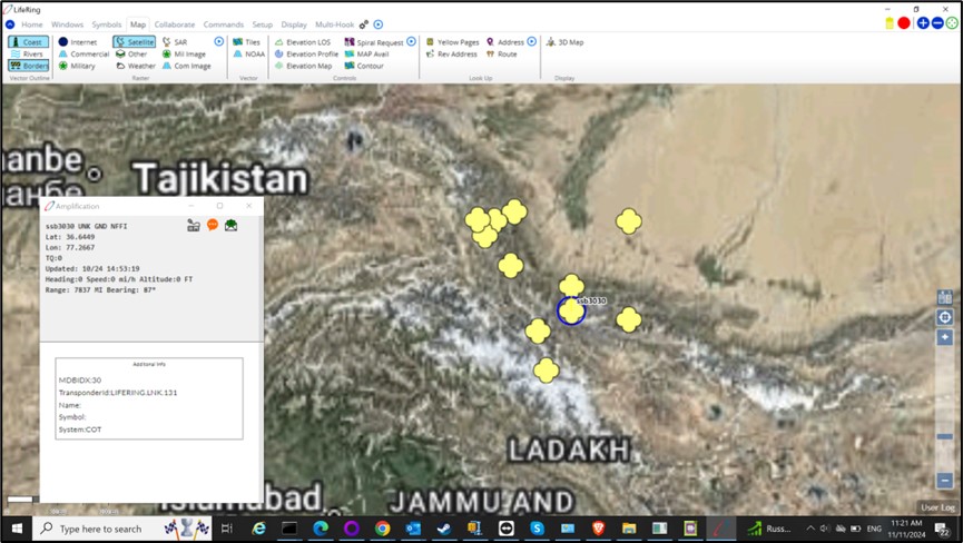
ADatP-36 data Displayed on a Georeferenced Satellite Image
A Full U.S./ NATO Link-16, JVMF, 0TH Gold, CoT, NATO NVG, ADEM, and ADatP-36 COP.
JUPITER, FL, UNITED STATES, December 3, 2024 /EINPresswire.com/ -- A First -- AGIS' Low-cost Joint All-Domain Command and Control (JADC2) system has been updated to Interface U.S. Air, Ground, and Sea forces with NATO forces using NATO's ADatP-36 data link. This will enable U.S. / NATO interoperability, allowing U.S. and NATO forces to have a multinational Common Operational Picture (COP) between all. With this integration, more cohesive operations can occur, lessening the chance of fratricide while simultaneously enabling increased operational effectiveness by providing a COP that all see on their pane of Glass, regardless of their nation or branch - as they share the COP,
AGIS’ addition of ADatP-36 along with Link-16, JVMF, 0TH Gold, CoT and NATO NVG, ADEM enables accurate and consistent data fusion from multiple (land, sea, air, cyber, and space) domains which is critical for Joint Operations. CJADC2 Operators from the different service branches need to view symbols that are representative of both friendly assets and threats as this enables them to make rapid informed decisions based on precise location, role, and status information for each of the battlefield elements. See the ADatP-36 data displayed on a georeferenced satellite image as a test at a nonrepresentative location.
Use of U.S. MIL-STD-2525 / NATO APP-6A symbology across the CJADC2 network ensures that all parties interpret situational information the same way. This reduces confusion and communication friction, particularly in high-stakes, rapidly changing operational environments.
This interface capability permits the AGIS CJADC2 System to coordinate NATO Air, Ground, Sea Operations and along with Commercial and military Satellite ELINT, Electro Optical, SAR and ELINT, it provides near real time feeds to significantly shorten the OODA Loop associated with military operations. AGIS' Group function assures that only the applicable information is sent to each Command Level. AGIS' Server examines the capacity of the communications at each command level and automatically adjusts the communications to that Command level. Automatic Fail Over communications between Cloud providers and on-premise servers is also provided.
Furthermore, since AGIS' C51SR CJADC2 system provides up and down the Chain of Command communications and UAV processing with automatic Al driven target detection (which is being expanded), this enables rapid integration of UAV data into the COP.
Because the explosion of intelligence data from satellites and UAVs can greatly exceed the database capacities available in U.S. and NATO systems, AGIS' Data Fabric Super User function provides the ability to select the volume and type of information transmitted from different sensor types to the various data users. See the AGIS Data Fabric image provided.
See www.agisinc.com/videos/LifeRingOverview.mp4
For information on this system, contact Cap Beyer at beyerm@agisinc.com or at 561-744-3213.
To get the latest version of any of the AGIS Thick client apps, go to www.agisinc.com/download
To try our Web client system, go to either www.liferingmilitary.com _or_ www.liferingfirstresponder.com.
Made in the USA by American Citizens
Malcolm K. Beyer, Jr.
Advanced Ground Information Systems (AGIS), Inc.
+1 561-744-3213
beyerm@agisinc.com
AGIS OODA Loop video
Distribution channels: Aviation & Aerospace Industry, International Organizations, Military Industry, Science, Technology
Legal Disclaimer:
EIN Presswire provides this news content "as is" without warranty of any kind. We do not accept any responsibility or liability for the accuracy, content, images, videos, licenses, completeness, legality, or reliability of the information contained in this article. If you have any complaints or copyright issues related to this article, kindly contact the author above.
Submit your press release
